Clouds can give big clues about the weather, so it makes sense for sailors to be able to identify the different types of clouds, and what they might mean for the people sailing below them.
While it is easy to focus on what the weather is happening at sea level, clouds give an indication of what is happening above us and provide a 3D picture of the movement of the atmosphere.
Lets look at some clouds!
A cloud is defined as suspended water in liquid droplet or ice crystal form. Clouds are condensed water vapour – i.e. it has changed from a gas to a liquid state. For this condensation to occur there must be some kind of condensation nuclei – these are small particles of dust, salt or smoke which have a suitable surface for water to stick to.
You can read more about how clouds are formed here. Basically they are formed by air rising and cooling until the dew point is reached – this is when the water condenses and becomes visible – as a cloud.
Clouds show us the stability of the atmosphere, and indicate where we are in a system. They can give the first indications of an approaching depression, and indicate future changes in the wind and reduced visibility in rain.
Clouds are classified by:
- Shape
- Vertical extent
- Altitude
Terminology:
- Cirro = High Level
- Alto = Mid Level
- Nimbo/Nimbus – High moisture content
- Cumulus – heaped or lumpy cloud
- Stratus – layers of flat cloud
- Cirrus – high wispy
High Cloud
High Cloud is defined as clouds over 17,000ft and above
- Cirrus (Ci)
- Cirrostratus (Cs)
- Cirrocumulus (Cc)
Cirrus (Ci)
Cirrus clouds are the highest and are made up of ice crystals. They indicate the presence of a jet stream and the possible approach of a warm front. No rain.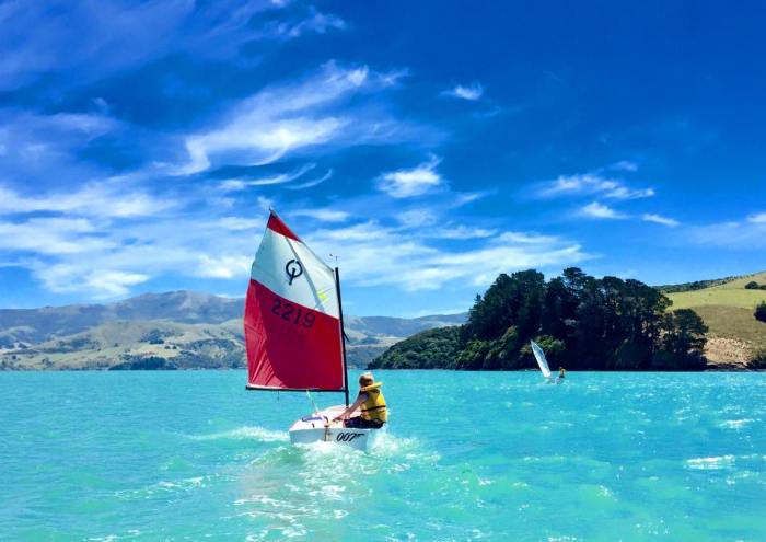
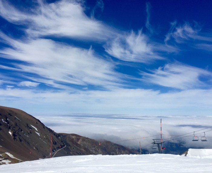 Cirrus above and thick stratus below – which was very challenging to drive through on the way back down the mountain.
Cirrostratus (Cs)
These clouds are also made up of ice crystals. As the cloud is very high, it is also very cold, and so the moisture content is also low. It is thin and the sun can still be seen – sometimes it is refracted creating a halo around the sun. No rain
Cirrocumulus (Cc)
This cloud resembles sheep’s wool. This cloud is also made up of ice crystals and the low temperature means low moisture. No rain.
Middle Cloud
Middle cloud is defined as clouds around 7,000 – 17,000ft and is called Alto
- Altostratus (As)
- Altocumulus (Ac)
Altostratus (As)
Mid level, featureless grey and overcast layer which extends for many miles. It produces lingering drizzle or light snow. 
Altocumulus (Ac)
Mid level cloud made up of joined or separated cloudlets. As it is lower it is warmer and will have a higher moisture content. Can be ice crystals and water droplets. This cloud comes in many different formations. Light rain possible.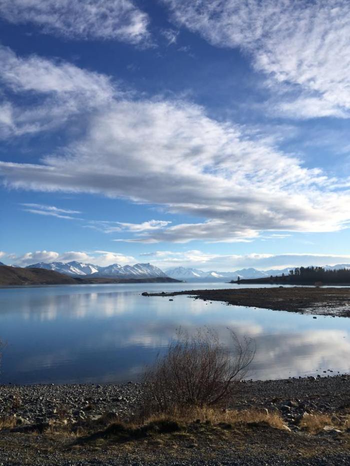
Low Cloud
Low cloud is considered to be from the ground to 7,000ft
- Stratus (St)
- Cumulus (Cu)
- Stratocumulus (Sc)
- Towering Cumulus (Tcu)
- Cumulonimbus (Cb)
- Nimbostratus (Ns)
Stratus (St)
Featureless grey overcast layer cloud – this forms very low and when it is at ground or sea level it is called fog or mist. 
Cumulus (Cu)
Fair weather clouds that form on sunny days. They generally have flat bases and cauliflower shaped tops. Very light or no rain. 
Stratocumulus (Sc)
Very common cloud – low layer, individual or joined up clumps or ‘cloudlets’. Stratocumulus and Altocumulus look very similar – the only difference is the base of the cloud height. Can have light showers. 
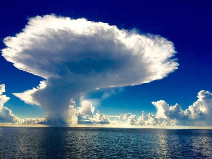
Towering Cumulus (Tcu)
When a normal fair weather cumulus grows taller than they are wide, then they become Towering Cumulus. They can then form in to Cumulonimbus clouds. They can produce heavy showers and have strong up draughts or wind beneath them.
 A beautiful Towering Cumulus cloud photo from the Bahamas courtesy of Byn Always from Oh Sail Yes blog.
 A beautiful towering cumulus in the Florida Keys by Jennifer MacLean from Sunshine Coast Adventures.
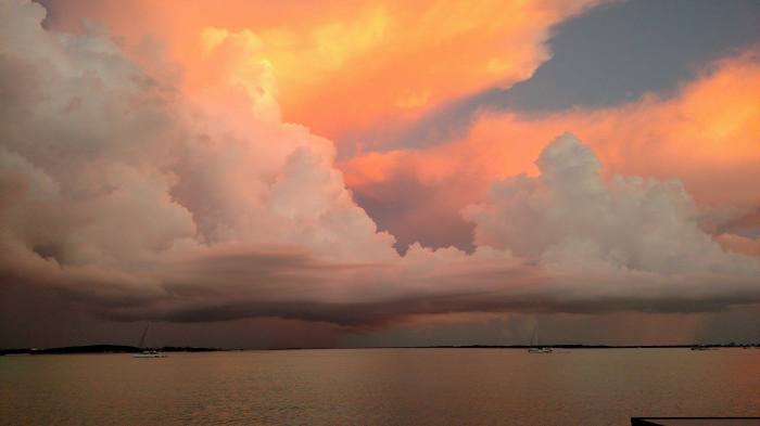
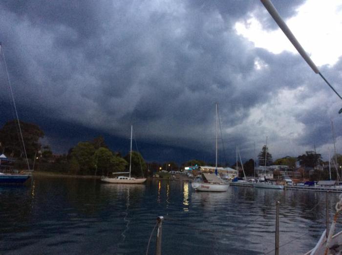
Cumulonimbus (Cb)
This is an enormous storm cloud which has a top shaped like an anvil. This indicates the direction in which the cloud is travelling. These clouds can form in to thunderstorms and have heavy showers and strong winds. The picture above probably isn’t a great example, but it shows a Southerly front approaching over Lyttelton Harbour.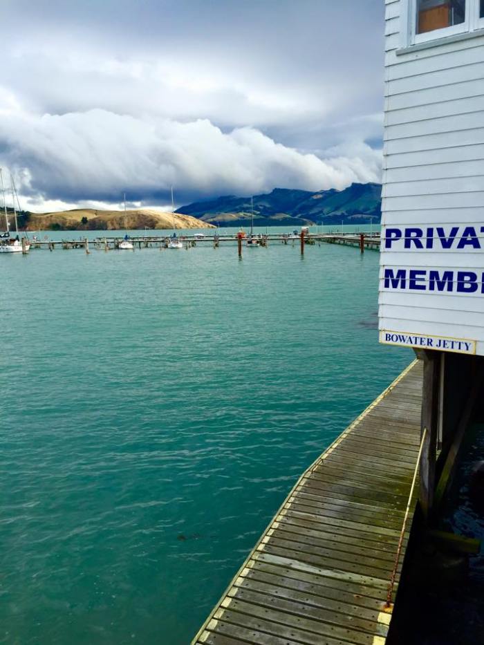
 Thunder Clouds over Lake Macquarie photo by Penny Anne Hodgson
Nimbostratus (Ns)
A depressing lingering cloud. It is thick, grey and featureless rain cloud. It is usually formed from thickening & lowering Altostratus clouds. Comes with moderate to heavy widespread rain.
There are many more different types of clouds, and hopefully my pictures are an accurate example of some of the clouds mentioned.
Check out Chris & Wade’s photos of clouds on their blog here: http://sv-takeiteasy.com/2014/07/24/head-in-the-clouds/
If you have got any better pictures please feel free to email them to me and I will add them to the post: astrolabesailing @ gmail.com
Check out my other Meteorology course posts:
- Atmospheric Pressure
- Atmospheric Moisture
- Ocean Currents
- Tropical Revolving Storms
- Wind


Hi Viki. We have always had weather dependent passions (paragliding as well as sailing), and clouds do tell us a lot about what’s coming. A little while back I did a post on clouds… Here is the link that might be of interest: http://sv-takeiteasy.com/2014/07/24/head-in-the-clouds/
LikeLiked by 1 person
Fantastic post thanks heaps Chris 🙂
LikeLiked by 1 person
Pingback: Meteorology – What about the wind…? | Astrolabe Sailing
Pingback: Meteorology – Atmospheric Moisture | Astrolabe Sailing
Pingback: Coastal Skipper | Astrolabe Sailing
Pingback: Meteorology – Tropical Revolving Storms | Astrolabe Sailing
Pingback: Meteorology – Weather Forecasts | Astrolabe Sailing
Pingback: Advanced Sea Survival | Astrolabe Sailing
Pingback: RYA Offshore Yachtmaster | Astrolabe Sailing
Pingback: Useful Marine Weather Links - Useful Marine Weather Links